| MD/DC/VA Archaea Site: Map to Burtonsville Park |
|
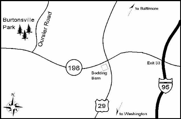
Directions to Burtonsville Community Park: Burtonsville Park is located in Burtonsville, MD (Montgomery County) off of Oursler Road, which is off of Burtonsville Road (Route 198). Burtonsville Park is one of the group's most used sites. From Baltimore take 95 South or Route 29 South to Route 198. Take on to 198 heading West. You will pass through Burtonsville (and the landmark Bedding Barn). Take 198 for a few miles passing a nursery/garden center, a cemetery, and houses. Make a right on to Oursler Road. The park entrance is the next immediate left. From Washington take 95 N or 495 to Route 29 North to Route 198. Take on to 198 heading West. You will pass through Burtonsville (and the landmark Bedding Barn). Take 198 for a few miles passing a nursery/garden center, a cemetery, and houses. Make a right on to Oursler Road. The park entrance is the next immediate left. The following map is not to scale.
|
|
© 1992-2002 Edmond Y. Chang. All rights reserved. Email the webmaster of this site. |